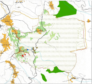
The main objective is to prepare Aerial Photogrammetric and Urban (Physical) Plans for Al Al-Mughayier, Kufr Malek, Abu Falah, Deir Debwan, and Dura Al-Qara in order to organize future expansion, plan public services, integrate physical development initiatives, optimize and rationalize the land uses, preserve the agricultural lands, and utilize resources in a suitable manner.
UG has provided the following services:
- Preparation of the aerial photography
- Identification of the Definition of the Planning Framework, Regional scope preparing the Sectoral Assessment, the preparation of Strategic Development Alternatives for the selected communities to facilitate making the decision by the LGUs on the Choice of the Most Favorable One.
- Preparing the Strategic Development Framewrok Plan which is the key guide for the Master Plan Design, Land Use Plan, and Zoning and Building Regulations.
- Preparation of roads and infrastructure development plans
- The provided services include also involving the public at various key stages on the project including on the assessment and choice among the development alternatives.

