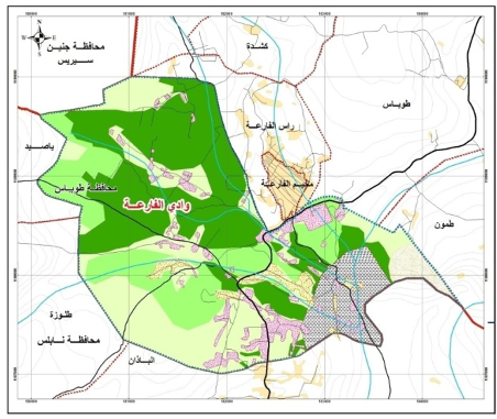
The main objective of this assignment is to develop Physical Plan for Al Fara Region, Tubas Governorate, and the associated communities. The project includes preparing the aerial photography and preparation of the relevancy GIS plans for the involved communities.
- Preparation the aerial and topographic map for the site
- Reviewing the project and gather any data needed for project analysis and design
- Studying the site and analyzing the natural settings, as well as the relations between the facilities, roads, and all other components
- Ensureing that the plan should be integrated with the regional and national contexts and linkages
- Studying and analyzing the infrastructure development networks in the community
UG provided the following services:
- Preparation of the aerial photography for Al-Faraa region
- Definition of the Planning Framework, preparing the Sectoral Assessment, the preparation of Feasible Strategic Development Alternatives for Al Fara Region, Tubas Governorate to facilitate making the decision by the LGUs on the Choice of the Most Favorable One
- Preparing the Master Plan Design, Land Use Plan, and Zoning and Building Regulations for Al Fara Region
- The provided services include also involving the public at various key stages on the project including on the assessment and choice among the development alternatives.